
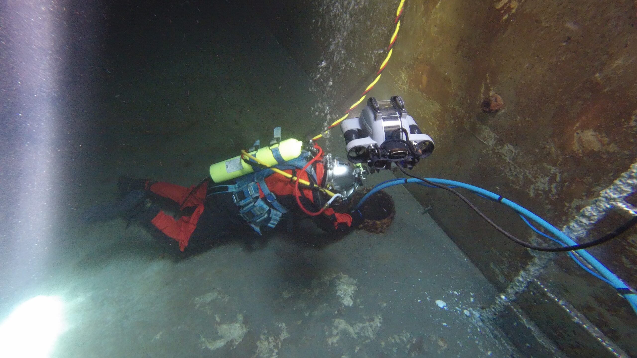
REMOTE OPERATED VEHICLE (ROV) INSPECTION SERVICES
Inland Divers deploys industry‑leading underwater ROV systems.
Our units deliver exceptional performance for inspection and exploration tasks, capture high‑definition 4K video and detailed still‑image data, ensuring precise documentation of underwater conditions.
Remotely Operated Vehicles (ROVs) are tethered, unoccupied underwater systems piloted from the surface, allowing safe and efficient exploration and execution of complex industrial tasks without requiring human divers. Outfitted with high‑definition cameras, powerful lighting, and advanced manipulators, they play a critical role in scientific research, infrastructure assessment, and a wide range of underwater inspection operations.

THE TECHNOLOGY
We don’t just “look” underwater; we map it.
Our ROV units support precise GPS‑based mapping and can overlay collected data directly onto Google Maps. This overlay provides a clear and accurate visual representation of the underwater conditions as well as leaving you with known GPS coordinates for your infrastructure.
Our inspection-class ROVs are equipped with 4K video, allowing us to generate detailed condition assessments even in turbid or deep-water conditions where human divers cannot go.
ROV & SONAR
Specialized Capabilities

Unlimited Bottom Time & Depth
Eliminate the risks associated with dive operations
Our ROV systems can conduct continuous inspections over long distances, including kilometers of pipeline or the full height of deep dam faces. This approach is ideal for assessing intakes below 100 feet or navigating extended tunnels and pipelines where diver access is limited or impractical.

SIDE SCAN SONAR IMAGING
Specialized underwater imaging
Side‑scan sonar is a specialized underwater imaging technology used to capture detailed representations of riverbeds, lake bottoms, and other submerged surfaces, even in zero‑visibility conditions. It provides high‑resolution acoustic imagery that supports accurate mapping, inspection, and environmental assessment.
We utilize sonar technology to create high-contrast acoustic images of the lakebed, identifying debris fields, structural scouring, or lost assets with pinpoint accuracy.
")
Advanced Geographical Information System (GIS)
GIS Services
Our team of highly qualified technicians is fully capable of acquiring the data required to deliver high-quality single-beam and multibeam bathymetric surveys.
You receive a professional engineering report flagged with time-stamped anomalies, measurements of defects,3D positioning data integrated into Google maps
Proudly ServingBritish Columbia
From the Okanagan to the Far North
Based in Kelowna, Inland Divers is the preferred diving contractor for the BC Interior. We provide rapid mobilization for marine construction projects across the entire province. Whether your project is located in the Okanagan, the Shuswap, the Kootenays, the Fraser Valley, on Vancouver Island, or up in Northern BC, our team is ready to deploy. We service all major regions from the interior lakes down to the Coast.

COMPLIANCE & ACCREDITATION
Inland Divers is fully insured and rigorously certified to handle the most demanding underwater challenges, serving the heart of the Okanagan and the broader British Columbia region.


REQUEST A PROPOSAL
Start Your Project with a Certified Partner
Contact our Okanagan office to discuss your scope of work, procurement requirements, or to request a site-specific safety plan.
OFFICE
Kelowna BC V1W-2H2